
~A Widdop Round~
27th April 2011
The fine, dry weather continues and I chose to revisit an area that was shoruded in mist and low cloud on the last occasion I was there. Widdop Moor backs on to Bouldsworth Hill and Widdop Reservoir is the first of the Yorkshire Water reserves that travellers encounter on a trip from Burnley to Hebden Bridge - on the back road from Briercliffe, Burnley.
Cludders Slack
Scroll down for photos and a description of the walk....
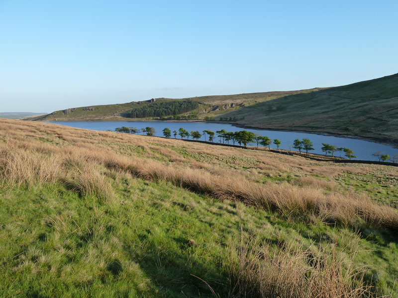
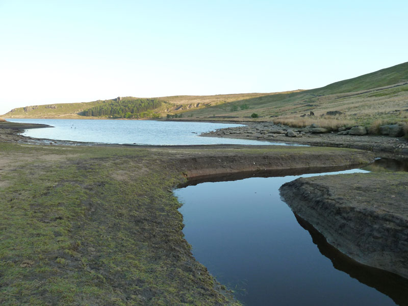
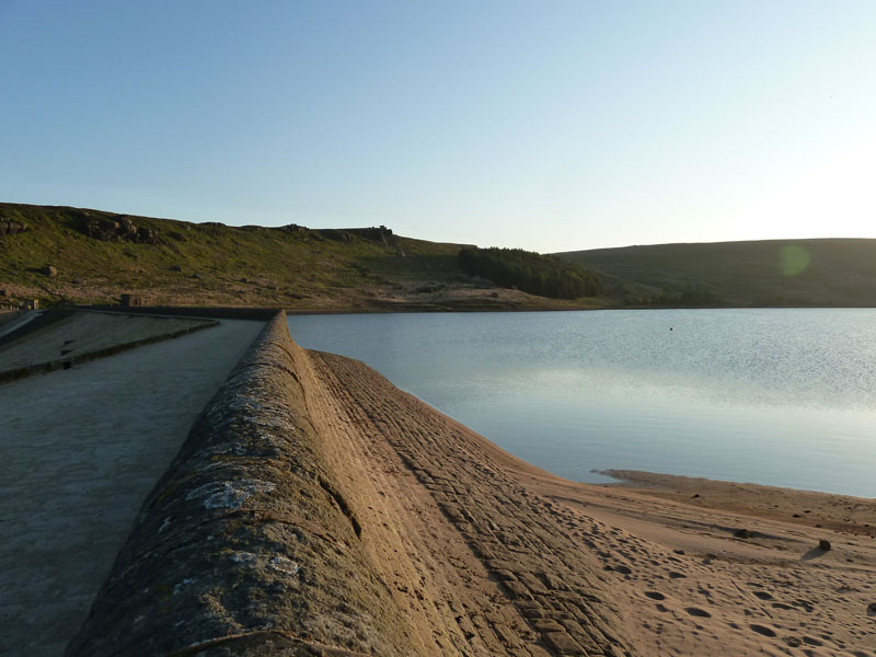
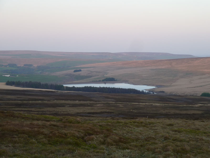
Widdop Reservoir
I parked at the upper end of the reservoir - Great Edge Bottom - on the map. My intention at the outset was to do a circuit of the reservoir and then gain height to watch the sunset. The rocky outcrops on the far side are known as Cludders Slack.
Widdop Reservoir
The level is declining after a very dry April.
 |
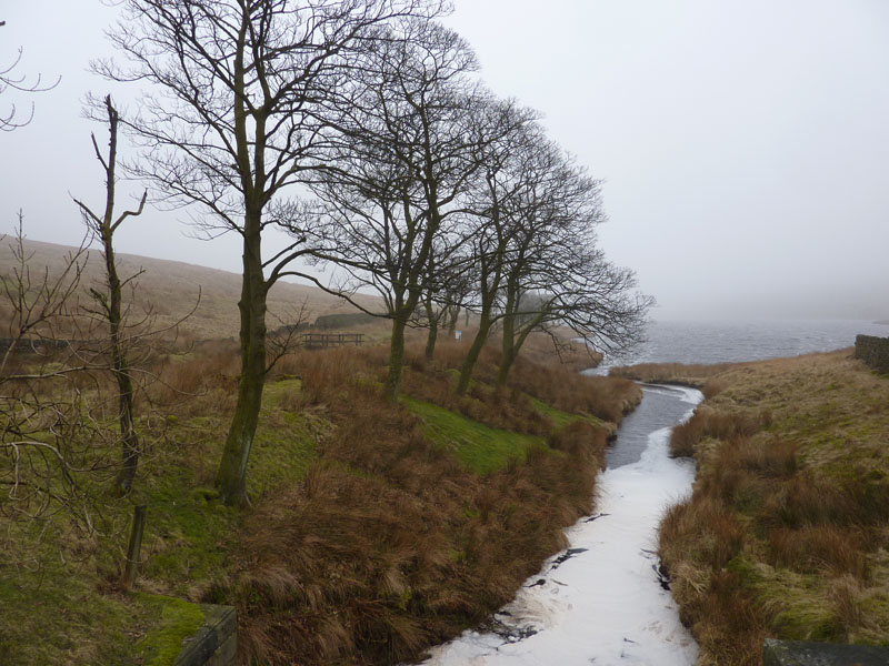 |
Widdop on a clear day |
Widdop on an unclear day (Feb 18th 2011) |
Seasonal Differences
Widdop Dam
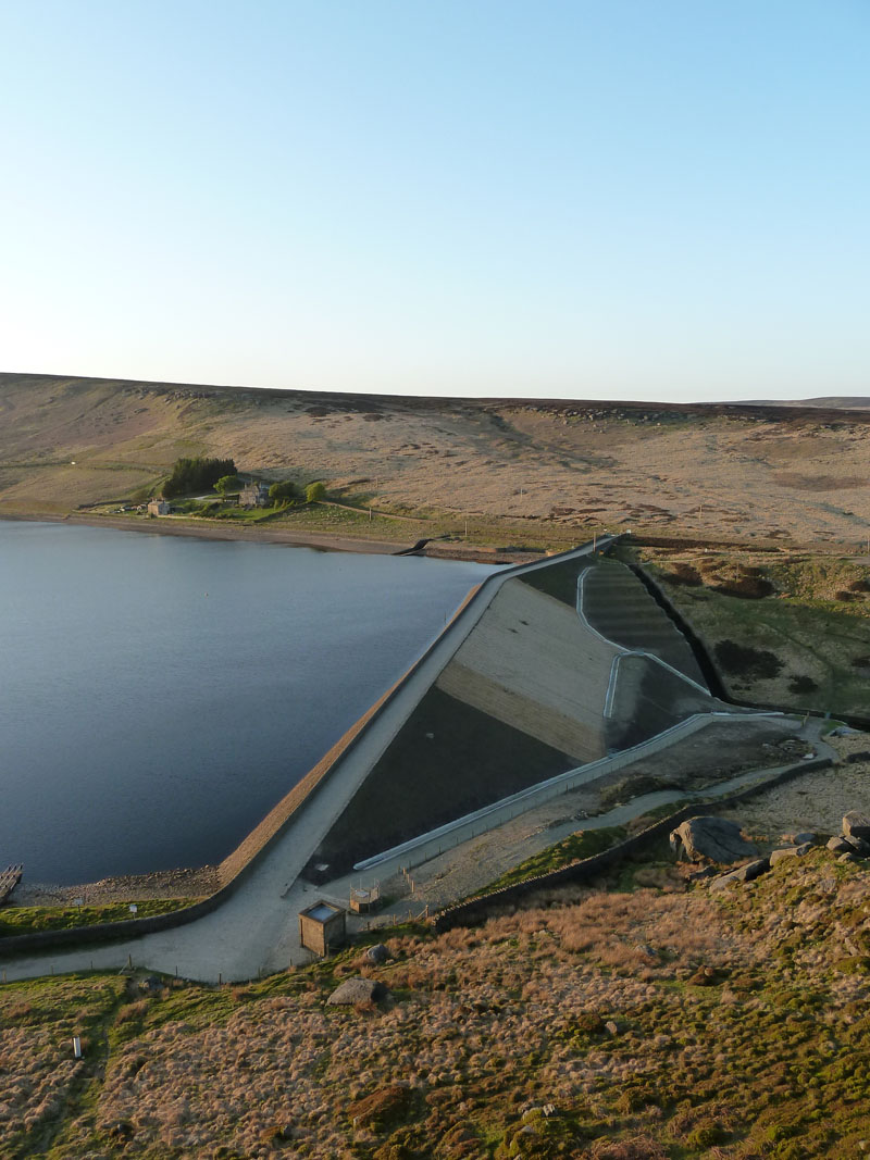
Widdop Dam
There is a steep climb up to Cludders Slack. The dam appears to have had money spent on it and the soil stabilisation material was highlighted in my last report. It should turn green - but it needs rainfall! The properties over there are called Higher Houses.
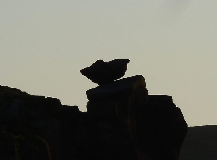
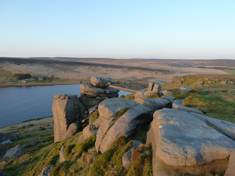
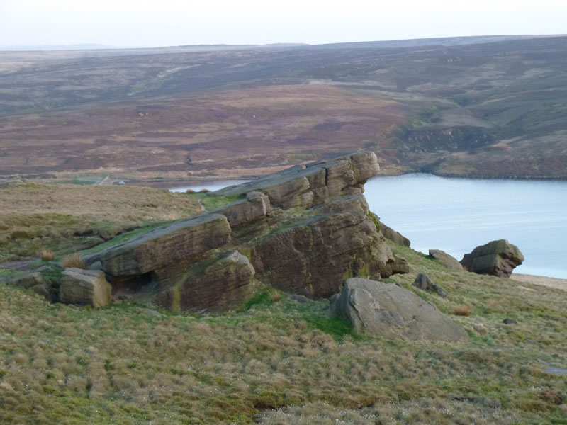
The Rocking Stone
I'm looking forward to having a closer look at the feature known as The Rocking Stone. In the meantime I've got a great vantage point, looking over Widdop Moor and the reservoir.
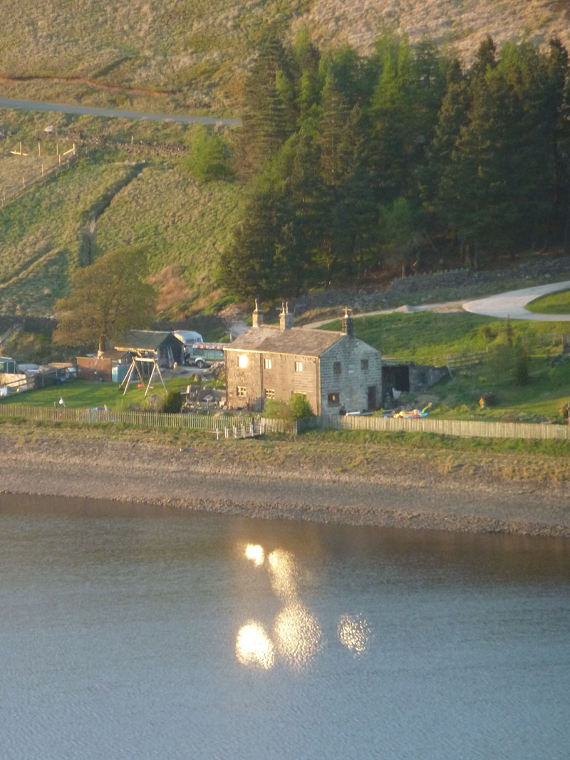
Higher Houses
The lower of the Higher Houses. Sunlight has reflected off their windows and bounced off the water right into my camera lens.
The Rocking Stone
I had to accept defeat. I have no doubt that I could have clambered up and crept under the rock on the right-hand side and then stood up on the far side and tested its rockability. But I had my best walking trousers on and the gritstone is like emery paper and I wasn't for ruining them. Oh, that and wife and family issues! There's uncomfortably large drops all around.
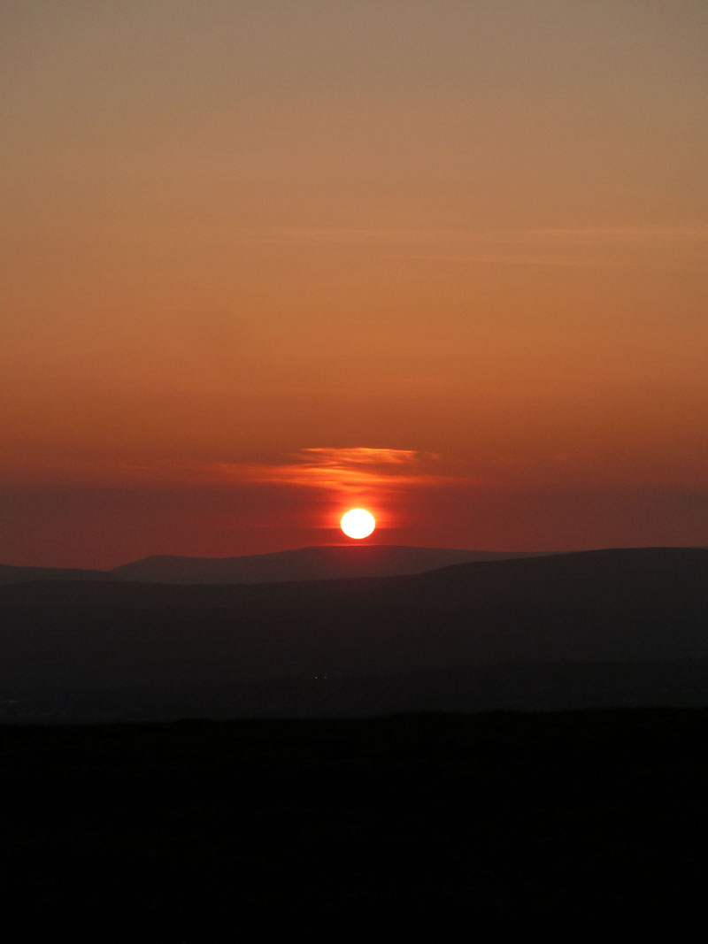
The Setting Sun
It's time to move quickly to the high point I'd indentified on the map as being a good place to be at 20:30hrs. I have 30 minutes to get there.
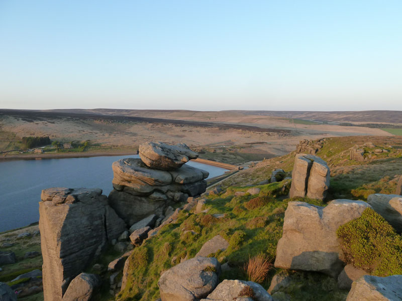
Clough Head Stones
Gorple Upper Reservoir is in view beyond the stones.
Gorple Lower Reservoir
I'm now climbing up to a point at approx 1500ft asl, marked on the map as Little Hill. Here boundary stones mark the Lancashire / Yorkshire border and I'm lurking behind enemy lines on this walk.
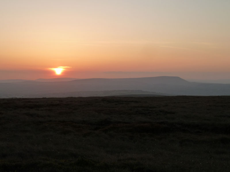
Pendle Hill
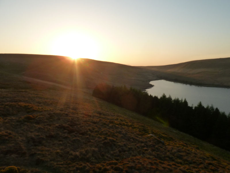
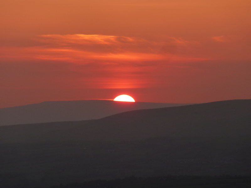
Arriving with less than 10 minutes to spare, I get my view of the setting sun over the Bowland territory of Fair Snape Fell, Pendle Hill to the right. My car is parked at 1140ft asl, so there is not that much effort required to get to this point.
Sunset over Fair Snape Fell
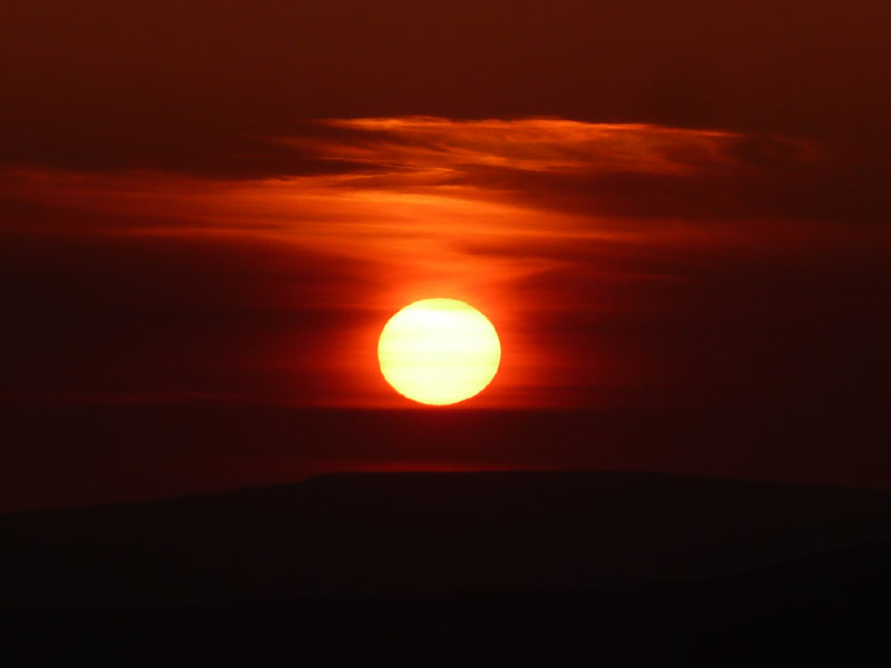
Sunset
The route back to the car was quite easy as it was a case of follow the farmer's track marks in the grass and keep an eye on the route of Birkin Clough. The latter part of this walk would have been quite unpleasant if the ground had not been so dry.
Cheerio! 20:31hrs
Walkers: Just Me.
Time taken: 2 hrs 30 mins over a distance of about 4 miles.
Route: Widdop Res, Cludders Slack, The Rocking Stone, Clough Head, Little Hill, Birkin Clough, road back to the car.
Weather and conditions: Sunny and cool.
Greetings Count: Nil.
Richard's Refreshment Review: Nothing to report.
All photos copyright Richard Ratcliffe 2011 ©
Take me back to the start ....